Powerful Polar Blast and Severe Weather Warnings Grip South Australia
South Australia is bracing for a significant weather event as a powerful polar blast sweeps across the region, bringing destructive winds, large ocean swells, and abnormally high tides.

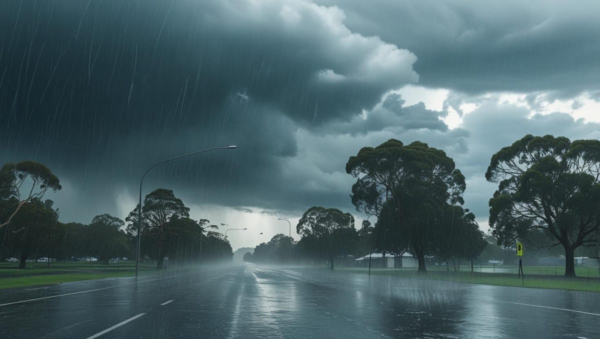
🌧️ Adelaide Weather Forecast – Monday, 26 May 2025
- Conditions: Cloudy with a very high chance of showers throughout the day.
- Temperature: High of 14°C, Low of 8°C.
- Rainfall: Expected between 8 to 25 mm.
- Winds: West to northwesterly winds at 30 to 45 km/h, shifting to west to southwesterly at 25 to 35 km/h during the day.
- Severe Weather Warning: A warning is in effect for damaging winds, with gusts potentially exceeding 110 km/h, especially in coastal and elevated areas.
Adelaide, SA – May 25, 2025 – South Australia is bracing for a significant weather event as a powerful polar blast sweeps across the region, bringing destructive winds, large ocean swells, and abnormally high tides. The South Australian State Emergency Service (SES) has issued severe weather warnings, urging residents to prepare for potentially hazardous conditions over the coming days.
According to the Bureau of Meteorology and Weatherzone, a series of cold fronts will bring classic winter weather to the state from Saturday through Tuesday, with wind gusts reaching up to 120 km/h in some areas. Coastal regions are expected to face the brunt of the storm, with ocean swells projected to rise between six and nine metres, potentially surpassing the previous May record of 8.5m. This comes just days before the highest tide of the year, expected on Wednesday, increasing the risk of coastal erosion and dangerous conditions along shorelines.
The SES has advised caution, particularly around coastal areas, as the storm surge could exacerbate risks for residents and visitors. “The rapid onset of destructive or damaging winds is often the main reason for damage to property and is responsible for bringing down power lines, causing power disruptions,” said SES State Duty Officer Craig Brassington. Authorities are also warning of potential power outages and hazardous driving conditions due to fallen trees and debris.
In response to the extreme weather forecast, a statewide Code Blue has been activated to support vulnerable populations during the cold snap. Temperatures are expected to plummet, with Monday’s high in Adelaide reaching only 17°C alongside showers and windy conditions, while Tuesday will see temperatures ranging between 10°C and 18°C with possible showers. Sunday is forecast to be particularly windy, with a high of 21°C and a low of 10°C, potentially making conditions feel even colder.
Strong wind warnings are in place for several coastal regions, including the Lower West Coast, Central Coast, South Central Coast, Investigator Strait, Upper South East Coast, and Lower South East Coast. Residents are urged to secure loose outdoor items, avoid unnecessary travel, and stay updated with the latest weather alerts.
This weather event follows a recent heatwave in late January, highlighting the region’s susceptibility to extreme weather shifts. As South Australia prepares for this polar blast, emergency services are on high alert, ready to respond to any impacts on infrastructure or public safety.
For the latest updates, residents are encouraged to monitor warnings from the Bureau of Meteorology and follow SES guidelines. Stay safe, Adelaide, as we weather this storm together.